New release
New Improvements to Mapidea, designed and delivered for a superior
user experience, making Location Analytics as simple as it can be.
Dashboard cards
Make your key information stand out with cards, available as an option in the Dashboard.

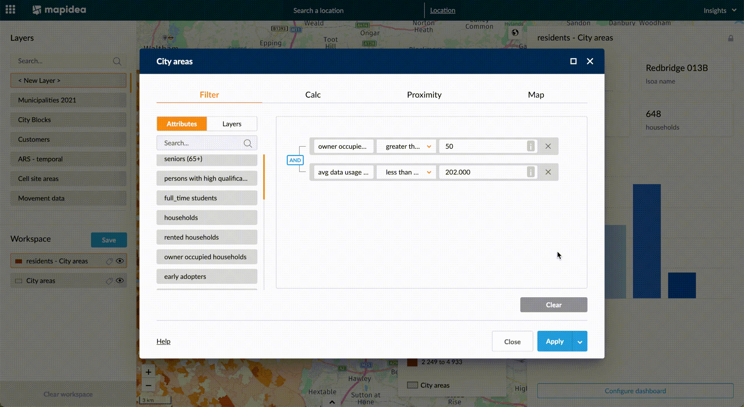
Maximize console
A single click to expand your filter and calculation console. More space to read every attribute name and operators.
Distance measure tool
Measure one or multiple distances in the map window. Feature configurable in the Role settings.


Other improvements
Multi-language
Each user can select their application language. Added Portuguese and Spanish (German is under preparation).
StreetView link
Drag & drop the streetview icon and immediatly a Google streetview window is open in that location.
Drive time / Walk time
It’s now possible to create a single drive or walk area for all elements in a layer.
Temporal charts
Zoom capabilities inside the temporal chart to focus on a specific period.
H3 Grid creation
Create grid from a csv or microsoft excel file using H3 codes.
Analysis description with Images
It’s possible to add images to the analysis description.